Saturday, March 10, 2012

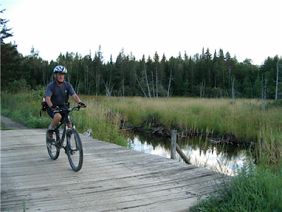
Bangor-Aroostook Trail

The www.traillinks.com map of the route
  The Bangor-Aroostook Trail is named for the railroad, and it's not too close to Bangor which is about 120 miles south of Presque Isle.
  This is a 58 mile long trail with plenty of opportunity for food and lodging along the way, but there are some remote areas too.  Always plan ahead and stock up accordingly. 
  There seems to be adequate parking at all trail "ends" so you could start at one end or someplace in between.
         I should have mentioned yesterday to remind people of mud season - many trails are
         closed during mud season.  Also there will be or may be black flies and mosquitoes.
  The trail of yesterdays blog also connects to this trail, it appears that a lot of people park in Caribou and then go in one direction or the other.
  Go take a hike!  well, maybe just a walk.
Caribou
On the trail. www.traillink.com
I could, or should, walk here.  www.traillink.com
Downtown Van Buren http://robwrightphoto.wordpress.com

Friday, March 9, 2012

Aroostook Valley Trail

Before we start:  This is a new series, thanks to Darlene who recommended it.  I'll dedicate this series to my daughter-in-law Darlene and her friend Nikki - two good walkers.  I think while I go through this it will also be kind of a "bucket list" that won't get a lot of action.  I still walk almost every day, but not at the pace I did a few years ago; but, I'd sure like to have a go at a few of these. \
  We will be talking about mostly rail trails in Maine and some of the Public Lands and State Parks too, are you ready to "take a hike!"?
A wooded section www.traillink.com
  Here is a trail, or trails in The County, you can use this trail from Presque Isle to New Sweden or to Washburn - or both.  I'll include a map that shows the "trail heads", marked with a "P", those are parking areas for your car while you walk.  This tail is about 28 miles, in each direction, so a 56 mile round trip if you want.
  The base of this trail is the rail bed of the only electric railroad Aroostook County had, used to take farm products to market and passengers to work or school.  The bed was re-worked for walking, biking, snowmobiles and AT V's and opened in 1994.
  Please go to www.traillink.com, it's all about rail trails nationwide, for more information on this trail, or just contact me (see the bottom of each days entry) and I'll write back with answers.
Where to go, the arrows or the P's.
Over the Aroostook River www,traillink.com
...and through the bogs.  www.traillink.com

Thursday, March 8, 2012

Wood Island Light

All is peaceful in the Wikipedia photo - click
  Wood Island sits just east of the mouth of the Saco River in Biddeford Pool.  The Light was built in 1806 and started operation the following year.  The first tower was made of wood and lasted until 1839 when the rubblestone tower replaced it, the keepers house was also replaced.  In 1858 the tower had some maintenance work done and a fifth-order Fresnel Lens was installed and then the keepers house was replaced with the current building, which has seen numerous improvement over the years.
  In 1972 the Lantern was remove from the tower and replaced with a rotating beacon, a loud public outcry about the headless lighthouse was cause for an aluminum lantern to be place on the tower, so it looked like a lighthouse should.
  This is number 67 in this series, and the final lighthouse story.  Tune in tomorrow for a new series about some other things in Maine.  And thanks for reading all this stuff too.
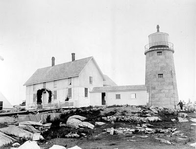
In the 1860's there were more buildings. U S Coast Guard photo
An early postcard.  www.mainememory.net
A more current photo from the American Lighthouse Foundation www.lighthousefoundation.org

Wednesday, March 7, 2012

Winter Harbor Light

A nice photo www.scenicusa.net
  Winter Harbor is on the west side of the Schoodic Peninsula and has been used as a "safe harbor" by fishermen and others seeking shelter from stormy waters.
  The Light is on a small (4 acres depending on the tide) island, Mark Island; and is sometime called the Mark Island Light. 
  Winter Harbor Light started operation on January 1, 1857 and since that time the keepers house has been replaced.  The Light was discontinued in 1934 and the whole property was sold at auction for $552.00!  It was sold again for $2,000.00 by the Richmond Family, professors at UMaine.  Bernice Richmond wrote the book Our Island Lighthouse.  The current owner is unlisted.
  You can view the Light from the entrance road to the Schoodic part of Acadia National Park, or some of the tour boats out of Bar Harbor.
I took this photo while going to Schoodic last early fall.
An undated Coast Guard photo
NOTE: There is one more lighthouse to write about (tomorrow).  If anyone has any ideas for a new subject leave a comment on this blog (see the little envelope at the bottom).  Myself, I am running out of ideas.

Tuesday, March 6, 2012

Whitlocks Mill Light

An old postcard www.americanhistory.si.edu
  The Saint Croix River between Calais and Eastport was a busy place in 1832.  Maine's first railroad, the Calais Railroad, would bring lumber from upstream to Calais where it would be loaded aboard steamers bound for Eastport to be shipped.  The Town/City would hang a red lantern on a tree to mark the American side of the "narrows".  That light was needed to help the steamers make the tight turn in the river.  By 1914 local leaders had convinced Congress and the new Light opened with a fourth order Fresnel Lens.
  Automated in 1969 with an optic lens the station was leases to the Washington County Community College.  Under the Light for Maine Program the ownership was transferred to the Saint Croix Historical Society.  The keepers house is now privately owned and the Light itself is not open to the public.  The Light can be viewed from the Saint Croix River Rest Area on Route 1, leaves obscure the view in summer.
  While in the Calais area try the Calais Rail Line walking path.  The rail bed of that first Maine railroad is now a trail.  The trail is 1.4 miles long and follows the river through the city center, but does not reach as far south as the rest area.
An undated Coast Guard photo.
A color photo
Try the trail, I will next spring/summer
The rest area is just south of the golf course, the trail is intown.


Monday, March 5, 2012

Whitehead Light

Nice enough! www.us-lighthouses.com
  Add this one to the list I talked about yesterday, Whitehead Light is another one in that area.  The Light sits on Whitehead Island, a granite base high above the water lever and 70 acres in size. Whitehead marks the southwestern entrance to the Muscle Ridge Channel of Penobscot Bay.  Owls Head Light is the northwestern marker.
  Built in 1804-1807 the 30 foot tower (lantern base) is block granite lined with brick.  The keepers house was located 60 to 70 feet from the tower. 
  The first keeper Ellis Dolph caused a scandal when he sold the spermaceti (whale) oil he ordered for the light, he would order extra and sell it, he was found out and fired.
  In 1933 the light was made electric, instead of oil, and the two steam boilers that powered the fog horns were replace by two internal combustion engines that ran an air compressor, there were two horns, one face the Muscle Ridge Channel and the other faced in the opposite direction.
  The Light became solar powered in 2001, the keepers house is long gone, but the other buildings remain.  The Island is owned by the Swan Family who run the Pine Island Camp on the 70 acres.
1852 http.lighthouse.cc
About 1870 www.wikipedia.com
A view from the top. http://lighthouse.cc

Sunday, March 4, 2012

Two Bush Island Light

Squared away! www.knox.villagesoup.com
  Two Bush island was named for the two small trees which were used as an aid before this Light was built.  Built in 1897 the Light marks the entrance to the Two Bush Channel in Penobscot Bay.
  By my quick count I think we've covered 7 lighthouses now within an easy driving distance of each other, IF you could drive on water; start with Rockland Breakwater and try to see how many you can find.
  The first hero of this remote island was Smut.  Smut was a Newfoundland Shepherd cross and known to be a smart dog.  His owner, keeper Altiverd Norton (the first keeper) reports that a fishing boat, the Clara Bella, was starting to break up in a storm near the island.  The two men on board were in a dory trying to find land when Smuts' barking led them to safety.  Yes, he knew, you see he hardly ever barked.
  As stated the Island is remote, four miles offshore it sits.  In January 1923 there were 21 snowstorms and it was below zero for 18 days in a row.  Rough stuff with no other buildings and no trees to break the wind, chilly indeed.
  Two Bush Light was automated in 1964 and the buildings, other than the Light, were demolished by the U S Army Green Berets as an exercise in 1970.  Solar power was added in 2000.
A Coast Guard aerial view of the Light and keepers quarters.
An early look with the natural brick tower.
Same picture as above but colored for this postcard.
www.americanhistory.si.com
Drive to the nearest land, what others could you see?